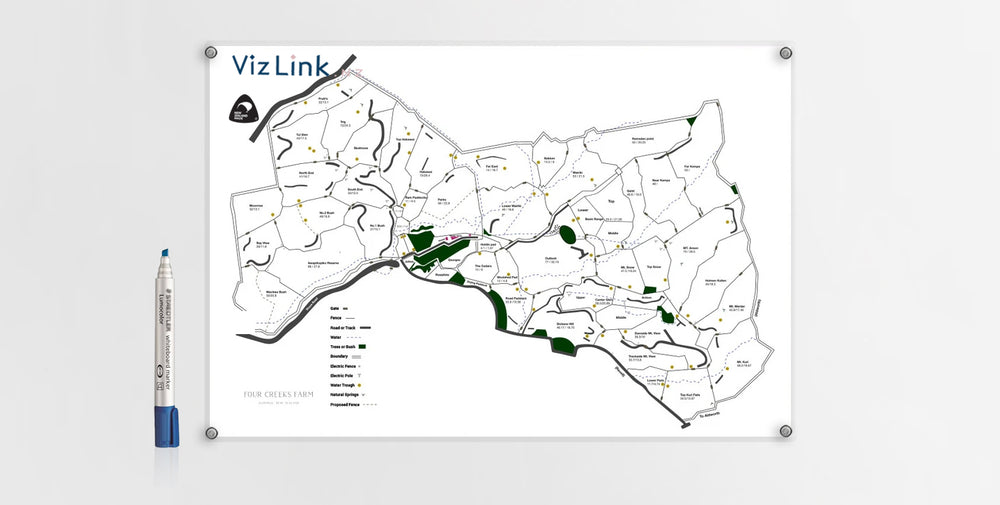

Drone technology was used to create this detailed map for our clients. We included fences, gates, electric poles, waterways, troughs, roads and boundaries as well as highlighted bush land and natural springs.
The sheep farmers required a detailed map and key to plan for mustering, to use as a focal point for team meetings and site inductions.